@robinuit/react-here-maps-library
v1.2.3TypeScript
Library to use the HERE map JS SDK in React
0/weekUpdated 3 years agoMITUnpacked: 849.8 KB
Published by RobinUit
npm install @robinuit/react-here-maps-library
🗺️ { React HERE Map } 🗺️


React library for rendering and working with
HERE Maps.
It simplifies the use of the HERE Map JavaScript API with the help of React
components.
The components can be imported and easily rendered. It also comes with seamless
configuration and modifications.
Feel like giving some support?
🚨 Report issues 🚨
⬅️ Make pull requests ➡️
⭐ Star this project ⭐
👀 / Overview
Since the creation of this library, many features have been added. At this point in time the following features are present and usable:
1. Display a (interactive) map in your webapp
2. Add (custom styled) markers, lines, circles, etc. to the map
3. Calculate and show routes between different coordinates
4. Calculate and show isochrone views by duration, distance or fuel consumption
5. Use GeoCoding to find locations or reverse search coordinates
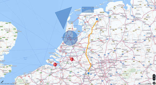
🎹 / Demo
🦺 / Requirements
``bash
Before you continue, ensure you meet the following requirements:
✅ You have a basic understanding of React
✅ You are using React 16.8 or above (hooks)
✅ You created an HERE developer account
✅ You located your HERE "app_id" and "app_code" or your "apiKey"
`
#### Can't check all boxes?
> Create an HERE Developer account
📌 / Installation
Using NPM:
`bash`
npm install react-here-map
Using Yarn:
`bash`
yarn add react-here-map
🕹️ / General Usage
`js
// Interactive map with UI, centered and zoomed on a defined location
import React from 'react';
import { HPlatform, HMap } from 'react-here-map';
function Map() {
const mapOptions = { center: { lat: 52.092876, lng: 5.10448 }, zoom: 7 };
return (
app_code='YOUR_APP_CODE'
interactive
includeUI
>
);
}
export default Map;
`
🗄️ / Folder structure
`h`
.
├── 📁 example // Example code (demo)
├── 📁 src
│ ├── 📁 components
│ ├── 📁 libs // Helpers (setup)
│ └── 📄 index.js // App entrypoint (defines all components)
├── 👗 .editorconfig
├── 👗 .eslintignore
├── 👗 .eslintrc
├── 🤷 .gitignore
├── 👗 .prettierrc
├── 👗 .travis.yml
├── 📄 .index.d.ts
├── 🔑 LICENSE
├── 📚 README.md
├── ✔️ TODO.md
├── 📦 package.json
└── 📦 🔑 package-lock.json
📝 / Docs
Usage of the map requires atleast the HPlatform and HMap components. All other components are optional.
- The HPlatform has to be the parent of the HMap.HMap
- The has to be the parent of all other components.HMap
- All other components have to be a direct child of the
`js
// Simplified representation
import React from 'react';
import { HPlatform, HMap, ...} from 'react-here-map';
function Map() {
return (
);
}
export default Map;
`
$3
1. HPlatform - Platform initializer
1. HMap - Draws the map
1. HMapMarker - Draws a marker on the map.
1. HMapMarkers - Draws a list of markers on the map.
1. HMapPolyline - Draws a polyline on the map.
1. HMapCircle - Draws a circle on the map.
1. HMapRectangle - Draws a rectangle on the map.
1. HMapPolygon - Draws a polygon on the map.
1. HMapRoute - Calculate and draw a route between two or more coordinates.
1. HMapPlaces - Use places.
1. HMapGeoCode - Turns a physical address to a point on the
map
1. HMapLayer - Add additional layers to the map.
Event Handling - Handling of user events with HMap and its objects.map.
$3
#### HPlatform
A container for all of the components in this library. Generates a platform that gets injected into all of its direct children.
`js static
// HPlatform with all possible props
import React from 'react';
import { HPlatform } from 'react-here-map';
function Map() {
return (
app_code='YOUR_APP_CODE'
apikey='YOUR_API_KEY'
version='v3/3.0'
language='EN'
mapType='normal.map'
interactive
includeUI
useLocation
includePlaces
useHTTPS
>
// All children go in here 🧒
);
}
export default Map;
`
| Prop name | Description | Type | Default value |
| ----------------- | ------------------------------------------------------------------------------------ | :-----: | :--------------: |
| app_id | HERE Application ID | String | _Required_ |
| app_code | HERE Application Code | String | _Required_ |
| apikey | HERE API key for usage with version 3.1 | String | - |
| version | HERE map API version | String | 'v3/3.0' |'EN'
| language | Language of the map and the UI (if included) - Options | String | (English) |'normal.map'
| mapType | Type of the map as a dot prop - Options | String | |false
| interactive | Makes the map react to events (drag, click, scroll, etc.). Needed for event handling | Boolean | |false
| includeUI | Add UI controls | Boolean | |false
| useLocation | Center the map on the current location of the user if permission is granted | Boolean | |false
| includePlaces | Add the module for working with places | Boolean | |true
| useHTTPS | Load the library using HTTPS | Boolean | |false
| ~~useCIT~~ | use the Customer Integration Testing (CIT) instead of the Production environment | Boolean | |
#### Language options
`h`
'EN' //English
'GER' //German
'SPA' //Spanish
'FIN' //Finish
'ITA' //Italian
'DUT' //Dutch
'POL' //Polish
'POR' //Portugese
'RUS' //Russian
'TUR' //Turkish
'CHI' //Chinese
#### Map types
`h
// normal.traffic, normal.base, etc.
normal: ["map", "traffic", "base", "xbase", "panorama", "labels", "transit"],
// satellite.xbase, satellite.label, etc.
satellite: ["map", "traffic", "base", "xbase", "panorama", "labels"],
// terrain.map, terrain.panorama, etc.
terrain: ["map", "traffic", "base", "xbase", "panorama", "labels"],
`
All direct children of the HPlatform component receive:
- platform A reference to H.service.platform
Docs
- options A reference to the options used to bootstrap the scripts:
See here
---
#### HMap
Displays the HERE Map
`js
import React from 'react';
import { HPlatform, HMap } from 'react-here-map';
function Map() {
const style = { width: '800px', height: '500px' };
const mapOptions = { center: { lat: 52.092876, lng: 5.10448 }, zoom: 7 };
return (
app_code='YOUR_APP_CODE'
apikey='YOUR_API_KEY'
interactive
includeUI
>
);
}
export default Map;
`
| Prop name | Description | Type | Default value |
| -------------- | --------------------------------------------------------------------------------------------------------------------- | :----: | :---------------------------------------: |
| style | Set style options for the map, like width and height | object | { width: '100%', height: '100%' } |{ center: { lat: 0, lng: 0 }, zoom: 2 }
| mapEvents | Options (Official Docs) | object | - |
| mapOptions | Options (Official Docs) | object | |
All direct children of the HMap component receive:
- map A reference to the map object used to create the visual map.
Docs
- platform A reference to H.service.platform
Docs
- ui A reference to the ui object that does inclusion of ui elements.
Docs
- \_\_options A reference to the options merged with writable defaults used
in bootstrapping the map and its items
> if you wish to render a supported component of this library outside
> the context of the map, make sure to render it in a place where the above props can
> be passed explicitly to avoid nasty, unfriendly errors.
> In some cases, as we will soon see, there is an option for passing a custom
> component with more enhancements (defined by the programmer), these props are
> received as first class directly from the containing parent and not from HMap,
> but still holds the same object references
---
#### HMapMarker
Puts a marker on the map at the provided coordinates. The coordinates must consist of an object with a lat and lng value.
`js
import React from 'react';
import { HPlatform, HMap, HMapMarker } from 'react-here-map';
function Map() {
const coords = { lat: 52, lng: 5 };
const icon =
' 'xmlns="http://www.w3.org/2000/svg">' +
'
'fill="white">H';
return (
app_code='YOUR_APP_CODE'
apikey='YOUR_API_KEY'
interactive
includeUI
>
);
}
export default Map;
`
| Prop name | Description | Type | Default value |
| ----------------- | ------------------------------------------------------------------------------------------------------------------- | :---------------------------------------------------------------------: | :------------: |
| coords | Object containing specified lat (latitude) and lng (longitude) values | object | _Required_ |false
| icon | Icon for the marker | bitmap
(An image URL, an SVG (string), an bitmap image or a canvas) | (default icon) |
| DOM | Display a marker that is capable of receiving DOM events | boolean | |true
| setViewBounds | Centers the line on the map | object | |
| options | Officially documented Options | object | - |
---
#### HMapMarkers
Puts markers on the map at the provided coordinates. The coordinates must consist of an array containing object with a lat and lng value.
`js
import React from 'react';
import { HPlatform, HMap, HMapMarkers } from 'react-here-map';
function Map() {
const points = [
{ lat: 52, lng: 5 },
{ lat: 51, lng: 4 },
{ lat: 50, lng: 3 }
];
const icon =
' 'xmlns="http://www.w3.org/2000/svg">' +
'
'fill="white">H';
return (
app_code='YOUR_APP_CODE'
apikey='YOUR_API_KEY'
interactive
includeUI
>
);
}
export default Map;
`
| Prop name | Description | Type | Default value |
| ----------------- | ------------------------------------------------------------------------------------------------------------------- | :-------------------------------------------------: | :------------: |
| points | Array containing objects with specified lat (latitude) and lng (longitude) values | array | _Required_ |false
| icon | Icon for the markers | bitmap
(image URL, SVG, bitmap image or canvas) | (default icon) |
| DOM | Display markers that are capable of receiving DOM events | boolean | |true
| setViewBounds | Centers the markers on the map | object | |
| options | Officially documented Options | object | - |
---
#### HMapPolyline
Draws a polyline on the map
`js
import React from 'react';
import { HPlatform, HMap, HMapPolyline } from 'react-here-map';
function Map() {
const points = [
{ lat: 52, lng: 5 },
{ lat: 52, lng: 6 },
{ lat: 53, lng: 6 }
];
const polyLineOptions = { style: { strokeColor: '#FF4507', lineWidth: 5 } };
return (
app_code='YOUR_APP_CODE'
apikey='YOUR_API_KEY'
interactive
includeUI
>
);
}
export default Map;
`
| Prop name | Description | Type | Default value |
| ----------------- | ------------------------------------------------------------------------------------------------------------------- | :----: | :-----------: |
| points | Array of (atleast 2) objects containing specified lat (latitude) and lng (longitude) values | Array | _Required_ |true
| options | Options (Official Docs) | object | - |
| setViewBounds | Centers the Polyline on the map | object | |
---
#### HMapPolygon
Draws a polygon on the map
##### Props
- points: PropTypes.array.isRequired - Array of objects containing lat and lng
of lat,lng string separated by comma.
- options: PropTypes.object - options for the polygon.
#### Usage
`js
import React from 'react';
import { HPlatform, HMap, HMapPolygon } from 'react-here-map';
function Map() {
const points = [
{ lat: 52, lng: 5 },
{ lat: 52, lng: 6 },
{ lat: 53, lng: 6 }
];
const polygonOptions = {
style: { strokeColor: '#FF4507', fillColor: 'yellow', lineWidth: 10 }
};
return (
app_code='YOUR_APP_CODE'
apikey='YOUR_API_KEY'
interactive
useHTTPS
includeUI
>
);
}
export default Map;
`
| Prop name | Description | Type | Default value |
| ----------------- | ------------------------------------------------------------------------------------------------------------------ | :----: | :-----------: |
| points | Array of (atleast 2) objects containing specified lat (latitude) and lng (longitude) values | Array | _Required_ |true
| options | Options (Official Docs) | object | - |
| setViewBounds | Centers the Polygon on the map | object | |
---
#### HMapCircle
Puts a circle on the map
##### Props
- coords: PropTypes.object.isRequired - Object with lat and lng for the
circle center point on the map
- options: PropTypes.object - Options for the circle.
Docs
- radius: PropTypes.number - The radius of the circle in kilometers
- setViewBounds: PropTypes.bool - Centers circle on the map. Default
true
##### Usage
`js
import React from 'react';
import { HPlatform, HMap, HMapCircle } from 'react-here-map';
function Map() {
const style = { height: '100%', width: '100%' };
const mapOptions = { center: { lat: 52.092876, lng: 5.10448 }, zoom: 7 };
const coords = { lat: 52, lng: 5 };
return (
app_code='YOUR_APP_CODE'
apikey='YOUR_API_KEY'
interactive
useHTTPS
includeUI
>
);
}
export default Map;
`
---
#### HMapRectangle
Puts a rectangle on the map
##### Props
- points: PropTypes.array.isRequired - Two element array with lat and lng specified. the first coord will be the top-left of the rectangle and the second the bottom-right
- options: PropTypes.object - Options for the rectangle.
Docs
- setViewBounds: PropTypes.bool - Centers the map with the circle. Default
true
##### Usage
`js
import React from 'react';
import { HPlatform, HMap, HMapCircle, HMapRectangle } from 'react-here-map';
function Map() {
const style = { height: '100%', width: '100%' };
const mapOptions = { center: { lat: 52.092876, lng: 5.10448 }, zoom: 7 };
const points = [
{ lat: 52, lng: 5 },
{ lat: 53, lng: 6 }
];
return (
app_code='YOUR_APP_CODE'
apikey='YOUR_API_KEY'
interactive
useHTTPS
includeUI
>
);
}
export default Map;
`
---
$3
This section demonstrates how to use an event with either HMap component or a
map object.
#### HMap Event Handling
No additional prop is required aside from those requiredby HMap. Below is apointerup
working code for a event:
To use an event, you have to pass interactive to the HPlatform and pass inuseEvents and mapEvents props to the HMap like this:
`js
import { HPlatform, HMap, HMapPolyline } from 'react-here-map';
app_code='YOUR_APP_CODE'
apikey={'YOUR_API_KEY_FOR_V3.1'}
useCIT
useHTTPS
interactive // Required for events
includeUI
includePlaces
>
height: '400px',
width: '800px'
}}
mapOptions={{ center: { lat: 52.5321472, lng: 13.3935785 } }}
useEvents // Required for events
mapEvents={{ pointerdown: (e) => console.log('Map Pointer Down', e) }} // event handlers
/>
;
`
#### Map Object event handling
All map object handles events the same way. Since all map objects are direct
children of HMap and receives HPlatform information, useEvents props inHMap
the tells the map objects to initialize events. So, a single useEvents
props is sufficient for all the children. In case that only a map object is
expected to handle events, can be passed to the object which willHMap
initialize events defined for that object and not on the rest of the other
sibling objects of the same parent.
##### Usage
`js
import HPlatform, {
HMap,
HMapCircle,
HMapMarker,
HMapPolygon,
HMapPolyline,
HMapRectangle
} from 'react-here-map';
const rectanglePoints = [51.5072, 0, 48.8567, 2.3508];
const rectangleOptions = {
style: {
fillColor: '#FFFFCC',
strokeColor: '#E8FA75',
lineWidth: 8
}
};
const circleCoords = { lat: 52.3667, lng: 4.9 };
const circleOptions = {
style: {
strokeColor: 'rgba(55, 85, 170, 0.6)', // Color of the perimeter
lineWidth: 2,
fillColor: 'rgba(0, 128, 0, 0.7)' // Color of the circle
}
};
const polyLinePoints = [
{ lat: 52.5167, lng: 13.3833 },
{ lat: 50.0833, lng: 14.4167 },
{ lat: 52.2333, lng: 21.0167 }
];
const polygonPoints = [45.4667, 9.1833, 0, 48.1333, 11.566, 0, 50.08, 8.24, 0];
const polygonOptions = {
style: {
fillColor: '#FFFFCC',
strokeColor: '#829',
lineWidth: 8
}
};
const markerCoords = { lat: 48.2, lng: 16.3667 };
const markerIcon =
' 'xmlns="http://www.w3.org/2000/svg">' +
'
'fill="white">H';
app_code='YOUR_APP_CODE'
apikey={'YOUR_API_KEY_FOR_V3.1'}
useCIT
useHTTPS
includeUI
interactive // Required for events
includePlaces
>
height: '400px',
width: '800px'
}}
useEvents // Required for events
mapEvents={{ pointerdown: (e) => console.log('Map Pointer Down', e) }} // event handlers
mapOptions={{
center: { lat: 51, lng: 7 },
zoom: 5,
pixelRatio: window.devicePixelRatio || 1
}}
>
radius={198000}
options={circleOptions}
objectEvents={{
pointerdown: (e) => console.log('Circle Pointer Down', e)
}}
/>
options={rectangleOptions}
objectEvents={{
pointerdown: (e) => console.log('Rectangle Pointer Down', e)
}}
/>
objectEvents={{
pointerdown: (e) => console.log('Polyline Pointer Down', e)
}}
/>
options={polygonOptions}
objectEvents={{
pointerdown: (e) => console.log('Polygon Pointer Down', e)
}}
/>
icon={markerIcon}
objectEvents={{
pointerdown: (e) => console.log('Marker Pointer Down', e)
}}
/>
;
`
---
#### HMapGeoCode
##### Props
- geoCodeParams: PropTypes.object - Depends on the type being used.
Default params
to be used when reverse and landmark are falsy,
reverse params
to be used when reverse is set to true,
landmark params
to be used when landmark is set to true
- children: PropTypes.element.isRequired - React Element that receives
map, platform, lat, lng as props
- reverse: PropTypes.bool - Should implement reverse geo coding
- landmark: PropTypes.bool - Should implement landmark geo coding
##### Usage
##### Address to positions
Converts an address to a position on the map
`js
import { HPlatform, HMap, HMapGeoCode, HMapMarker } from 'react-here-map';
const geoCodeParams = {
searchText: '200 S Mathilda Ave, Sunnyvale, CA'
};
const icon =
' 'xmlns="http://www.w3.org/2000/svg">' +
'
'fill="white">H';
// Can render any map element, make sure to pass map and platform as props to the children to avoid unwarranted behavior
const GeoMarker = ({ map, platform, ui, lat, lng, key }) => (
map={map}
platform={platform}
key={key}
icon={icon}
/>
);
// Child of HMapGeoCode receives same params as above.
app_code='YOUR_APP_CODE'
apikey={'YOUR_API_KEY_FOR_V3.1'}
useCIT
useHTTPS
includeUI
includePlaces
>
height: '400px',
width: '800px'
}}
mapOptions={{ center: { lat: 52.5321472, lng: 13.3935785 } }}
>
;
`
##### Position to address(es)
Converts a position to address(es) on the map
`js
import { HPlatform, HMap, HMapGeoCode } from 'react-here-map';
// Create the parameters for the reverse geocoding request:
const reverseGeoCodingParameters = {
prox: '52.5309,13.3847,150',
mode: 'retrieveAddresses',
maxresults: 1
};
// Can render any map element, make sure to pass map and platform as props to the children to avoid unwarranted behavior
const ReverseGeoMarker = ({ map, platform, ui, lat, lng, location, key }) => {
ui.addBubble(
new H.ui.InfoBubble(
{ lat, lng },
{ content: location.Location.Address.Label }
)
);
return null;
};
// Child of HMapGeoCode receives same params as above.
app_code='YOUR_APP_CODE'
apikey={'YOUR_API_KEY_FOR_V3.1'}
useCIT
useHTTPS
includeUI
includePlaces
>
height: '400px',
width: '800px'
}}
mapOptions={{ center: { lat: 52.5321472, lng: 13.3935785 } }}
>
;
`
###### Landmark Point
Locate landmark positions on the map
`js
import { HPlatform, HMap, HMapGeoCode } from 'react-here-map';
const LandmarkGeoMarker = ({
map,
platform,
ui,
lat,
lng,
location,
key,
_location
}) => {
ui.addBubble(new H.ui.InfoBubble({ lat, lng }, { content: _location.Name }));
return null;
};
// Create the parameters for the landmark search request:
const landmarkSearchParameters = {
searchText: 'TXL'
};
// Child of HMapGeoCode receives same params as above.
app_code='YOUR_APP_CODE'
apikey={'YOUR_API_KEY_FOR_V3.1'}
useCIT
useHTTPS
includeUI
includePlaces
>
height: '400px',
width: '800px'
}}
mapOptions={{ center: { lat: 52.5321472, lng: 13.3935785 } }}
>
;
`
---
#### HMapRoute
> This uses React Hooks. Ensure that your react installation supports Hooks API
##### Displaying route on the Map Using normal line
Shows path to between two points based on params
##### Props
- routeParams: PropTypes.object -
Officially documented route params
- lineOptions: PropTypes.object -
Officially supported poly line options
- icon: PropTypes.any - Icon to be used for the marker
- markerOptions: PropTypes.object -
Officially supported marker Options
- children: PropTypes.element - React element that receives
map, platform, ui, route, key, routeShape as props
- renderDefaultLine: PropTypes.bool - Should use default renderer instead of
a custom renderer as children
- isoLine: PropTypes.bool - Use IsoLine instead of a Polyline
##### Usages
###### Using the default renderer
`js
import React from 'react';
import { HPlatform, HMap, HMapRoute } from 'react-here-map';
import config from '../../config';
function Map() {
const style = { height: '100%', width: '100%' };
const mapOptions = { center: { lat: 52.092876, lng: 5.10448 }, zoom: 7 };
const waypoints = [
{ lat: 52, lng: 5 },
{ lat: 53, lng: 6 }
];
return (
app_code={config.HERE_APP_CODE}
apikey={config.HERE_API_KEY}
interactive
useHTTPS
includeUI
>
waypoints,
mode: 'fastest;car;traffic:disabled',
representation: 'display'
}}
>
);
}
export default Map;
`
###### Using a custom renderer
`js
import React from 'react';
import { HPlatform, HMap, HMapRoute } from 'react-here-map';
import config from '../../config';
function Map() {
const style = { height: '100%', width: '100%' };
const mapOptions = { center: { lat: 52.092876, lng: 5.10448 }, zoom: 7 };
const waypoints = [
{ lat: 52, lng: 5 },
{ lat: 53, lng: 6 }
];
function Route({map, platform, ui, route, key, routeShape}: any) {
return (
)
}
return (
app_code={config.HERE_APP_CODE}
apikey={config.HERE_API_KEY}
interactive
useHTTPS
includeUI
>
waypoints,
mode: 'fastest;car;traffic:disabled',
representation: 'display'
}}
renderDefaultLine={false}
>
);
}
export default Map;
`
#### Displaying route on the Map using iso line
##### Using the default renderer
`js
import { HPlatform, HMap, HMapPolygon, HMapRoute } from 'react-here-map';
// Create the parameters for the reverse geocoding request:
const isoRoutingParams = {
mode: 'fastest;car;',
start: 'geo!52.5,13.4',
range: '900',
rangetype: 'time'
};
const routeLineOptions = {
style: { strokeColor: 'blue', lineWidth: 10 },
arrows: { fillColor: 'white', frequency: 2, width: 0.8, length: 0.7 }
};
const icon =
' 'xmlns="http://www.w3.org/2000/svg">' +
'
'fill="white">H';
const RouteMarkerIso = ({ map, platform, ui, route, routeShape, center }) => {
return (
options={polygonOptions}
setViewBounds
map={map}
platform={platform}
/>
map={map}
platform={platform}
icon={icon}
options={markerOptions}
setViewBounds={false}
/>
);
};
app_code='YOUR_APP_CODE'
apikey={'YOUR_API_KEY_FOR_V3.1'}
useCIT
useHTTPS
includeUI
includePlaces
>
height: '400px',
width: '800px'
}}
mapOptions={{ center: { lat: 52.5321472, lng: 13.3935785 } }}
interactive
includeUI
>
icon={icon}
isoLine
defaultDisplay
lineOptions={routeLineOptions}
/>
;
`
##### Using a custom renderer
`js
import { HPlatform, HMap, HMapPolygon, HMapRoute } from 'react-here-map';
// Create the parameters for the reverse geocoding request:
const isoRoutingParams = {
mode: 'fastest;car;',
start: 'geo!52.5,13.4',
range: '900',
rangetype: 'time'
};
const routeLineOptions = {
style: { strokeColor: 'blue', lineWidth: 10 },
arrows: { fillColor: 'white', frequency: 2, width: 0.8, length: 0.7 }
};
const icon =
' 'xmlns="http://www.w3.org/2000/svg">' +
'
'fill="white">H';
const RouteMarkerIso = ({
map,
platform,
ui,
route,
routeShape,
center,
component
}) => {
return (
options={polygonOptions}
setViewBounds
map={map}
platform={platform}
/>
map={map}
platform={platform}
icon={icon}
options={markerOptions}
setViewBounds={false}
/>
);
};
app_code='YOUR_APP_CODE'
apikey={'YOUR_API_KEY_FOR_V3.1'}
useCIT
useHTTPS
includeUI
includePlaces
>
height: '400px',
width: '800px'
}}
mapOptions={{ center: { lat: 52.5321472, lng: 13.3935785 } }}
interactive
includeUI
>
icon={icon}
defaultDisplay={false}
isoLine
lineOptions={routeLineOptions}
>
;
`
---
#### HMapLayer
Adds a layer to the map.
Individual layer holds different information
##### props
mapLayerType: PropTypes.string.isRequired In a dot prop form e.g
mapLayerType="incidents", mapLayerType="normal.traffic"
`js static`
{
normal: [
"xbase",
"xbasenight",
"base",
"basenight",
"map",
"mapnight",
"traffic",
"trafficnight",
"transit",
"panorama",
"panoramanight",
"labels",
"metaInfo"
],
satellite: ["xbase", "base", "map", "traffic", "panorama", "labels"],
terrain: ["xbase", "base", "map", "traffic", "panorama", "labels"],
incidents: true
}
##### Usage
`js
import React from 'react';
import { HPlatform, HMap, HMapLayer } from 'react-here-map';
function Map() {
const style = { height: '100%', width: '100%' };
const mapOptions = { center: { lat: 52.092876, lng: 5.10448 }, zoom: 7 };
const points = [
{ lat: 52, lng: 5 },
{ lat: 53, lng: 6 }
];
return (
app_code='YOUR_APP_CODE'
apikey='YOUR_API_KEY'
interactive
useHTTPS
includeUI
>
);
}
export default Map;
`
---
#### HMapPlaces
Search for places on the map
$3
- library: PropTypes.string.isRequired One of the places library supported
by HERE maps for the requests
- query: PropTypes.string Passing the query externally to initiate the
request on load after getting the location of the user
- category: PropTypes.string Result category
- placeClassName: PropTypes.string Class for the container
- inputClassName: PropTypes.string Class for the Input field
- containerStyle: PropTypes.object Styles for the container
- inputStyle: PropTypes.object Styles for the input
- itemContainerClass: PropTypes.string Result Items container class
* itemClass: PropTypes.string Result Items class
* iconClass: PropTypes.string Icon marker class name
* inputStyle: PropTypes.object Styles for the input
* getItem: PropTypes.function Callback when an item is clicked in the result
- markerOptions: PropTypes.object Options for the marker
- markerIcon: PropTypes.element Icon for the marker
- markerType: PropTypes.string Type of marker icon
* multiMarker: PropTypes.boolean allow for many markers
$3
`js
import { HPlatform, HMap, HMapPlaces } from 'react-here-map';
app_code='YOUR_APP_CODE'
apikey={'YOUR_API_KEY_FOR_V3.1'}
useCIT
useHTTPS
includePlaces
interactive
>
;
``
---
🧑💻 / Authors
|
Aleem Isiaka |
Robin Uitbeijerse |
| :--------------------------------------------------------------------------------------------------------------------------------------------------------------------------------------------------------------------------: | :------------------------------------------------------------------------------------------------------------------------------------------------------------------------------------: |


📅 / Changes
06/05/2020
- Includes support for v3.1 API key
✔ / TODO
Want to know what we are working on or care to add some new features yourself?
> Check the TODO
🔑 / Licence
This project has been created under the MIT License.
> Check the LICENSE.
Feel like giving some support?
🚨 Report issues 🚨
⬅️ Make pull requests ➡️
⭐ Star this project ⭐